Fáilte
Tooreen Summary
CIVIL PARISH OF KILFARBOY - R.C. PARISH OF MILTOWN MALBAY.
TOWNLAND OF TOOREEN.
Townlands are the smallest administrative unit of Irish local government. The network of townlands, as it now stands was laid out in the first half of the 19th century. The Boundary Survey commenced work in 1824, marking out, on the ground, where necessary, the actual boundaries of every townland. Where they felt it necessary, they subdivided the pre-existing land divisions, to create smaller units. The Ordnance Survey built on the work of the Boundary Commission to produce maps of the entire country at a scale of 6” to the statute mile. This was done in County Clare during the 1830s.
As part of their work the Ordnance Survey carried out an extensive documentary and field survey of placenames and recorded the results of their work in Field Name Books. Some, but not necessarily all of the names recorded in the Field Name Books were incorporated in the subsequent maps. The Ordnance Survey set down definitive names for each townland and also for other features entered in the Name Books, these were signed with the initials J oD, presumably for John O Donovan, although not all of the initials were by the same hand. The information collected during the 1830s was first published in map of 1842
Prior to the development of the townland system the lands of Ibrickane Barony were denominated in ‘quarters’ and the earliest known list of these quarters is from a survey of the O Brien estates by Henry Illsworth in 1615 in which he lists 63 quarters and gives the names of the immediate lessors. Further surveys by the O Brien Estates always accounted for approximately the same number of quarters - 63. In the early surveys Tooreen was not listed as a land division in its own right and, rather unusually, when they came to laying down the townland network the Boundary Commission made significant changes to the structure of the ‘quarters’ by taking a part of the pre-existing quarter of Kilfarboy and part of the pre-existing quarter of Glendine and joining these parts to form the new townland of Tooreen. Under the earlier ‘quarters’ system the townland of Kilfarboy included, as well as this section of Tooreen and the present townland of Kilfarboy, the present townlands of , Drumbaun, Leeds, Slievenalicka, or Rockmount part of Aillbrack and part of Toor. The pre-existing quarter of Glendine would have included the present-day townlands of Glendine North and South and also Caherogan, Knockbrack, Cloughan Beg, and part of Tooreen, (although Cloughan Beg was often treated as a quarter in its own right) It will be clear, therefore that references to Glendine and Kilfarboy prior to the 1850’s can be read as including Tooreen. In summary, then from the pre-existing quarters of Moy More, Kilfarboy, Lackamore and Glendine the Boundary Commission created the following townlands:
New townland Previously part of:
Tooreen Glendine and Kilfarboy.
Caherogan Glendine
Knockbrack Glendine
Glendine North Glendine
Glendine South Glendine
Cloughan Beg Glendine, sometimes a quarter in itself.
Kilfarboy Kilfarboy
Aillbrack Kilfarboy and Moy More
Toor Kilfarboy and Moy More
Drumbaun Kilfarboy
Leeds Kilfarboy
Slievenalicka (Rockmount) Kilfarboy
Illaunbaun Kilfarboy and Lackamore
Clooneyogan South Moy More and Lackamore
Clooneyogan North Moy More
Moy More Moy More.
Note that Moy Beg existed as a quarter and townland, in its own right.
The above information is extracted from pencilled notes in the Book of Survey and Distribution, the author of the pencil notes is unknown.
In all, the Ordnance Survey created 110 townlands (counting Mutton Island as one) from the earlier 63 quarters, which comprised the Barony of Ibrickane. Thus Kilfarboy has 40 townlands, Kilmurry Ibrickane 51 (including Mutton Island) and Killard 19.
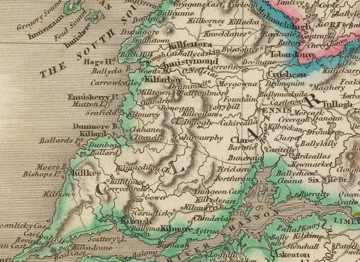
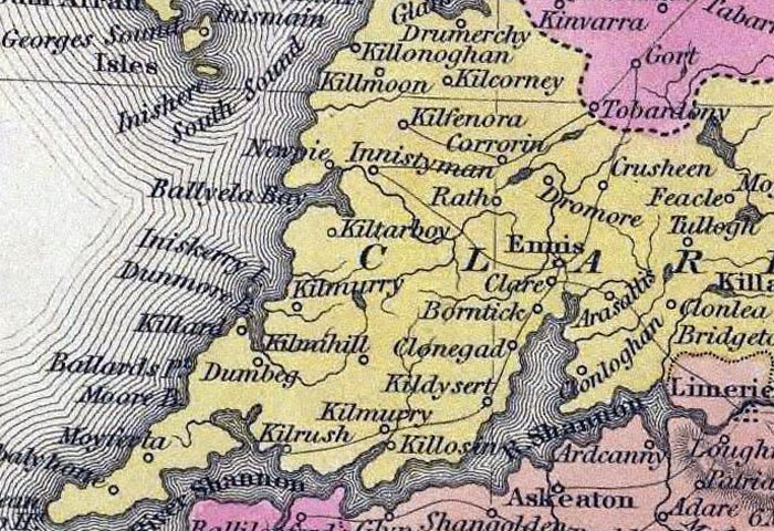
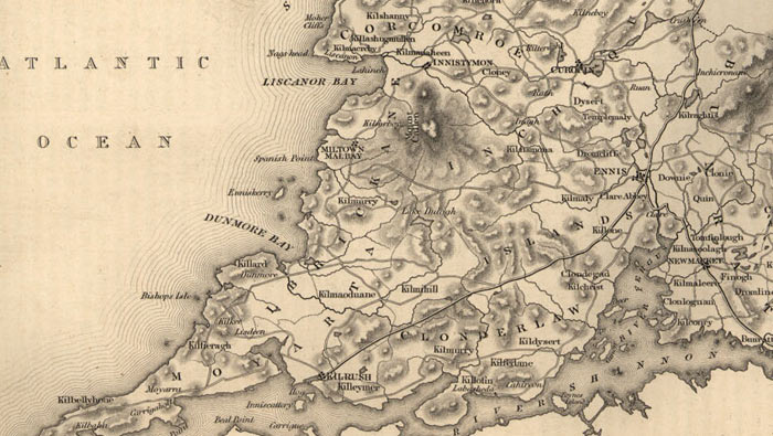
Early maps.
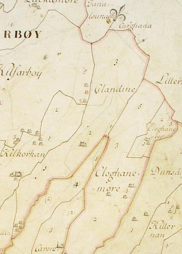
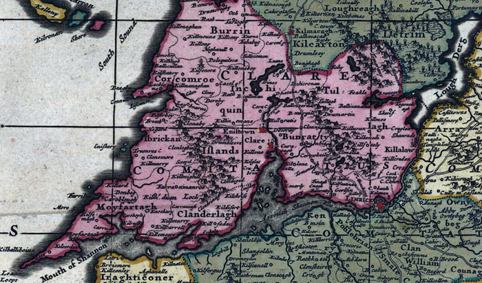
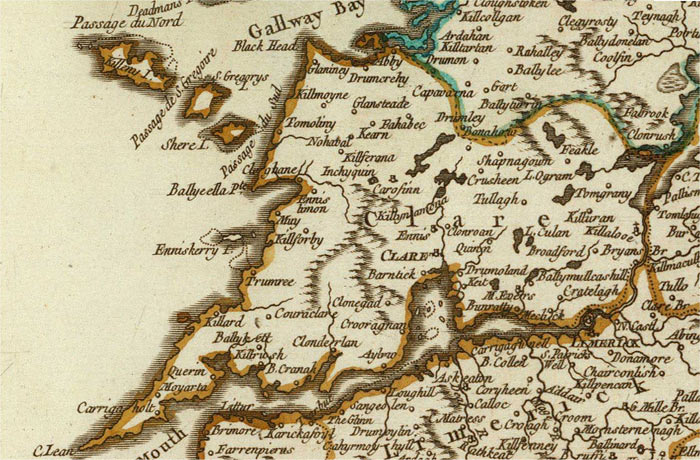
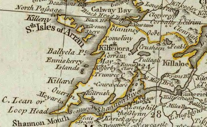
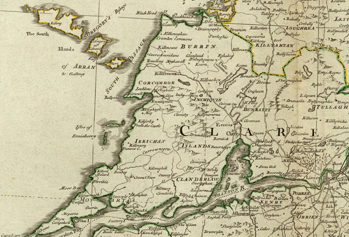
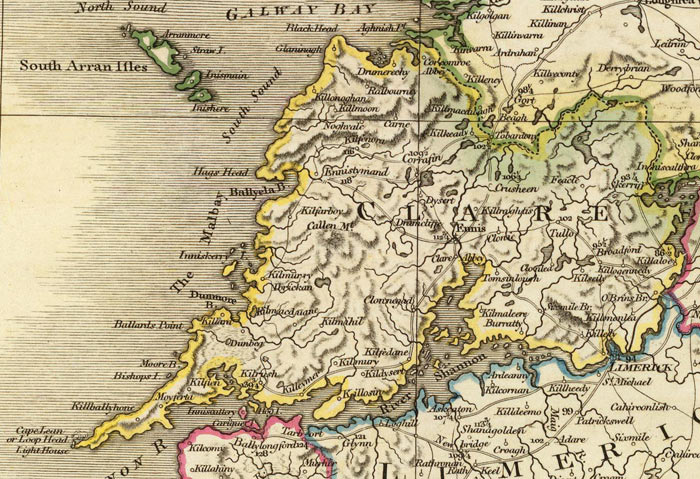
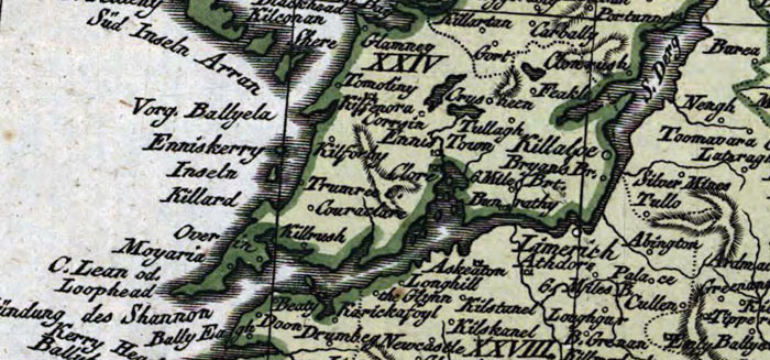
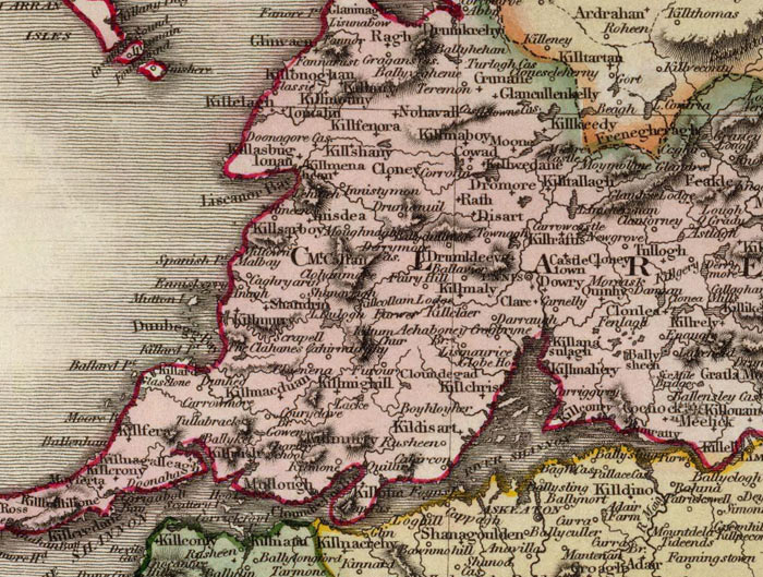
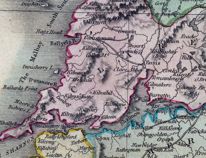
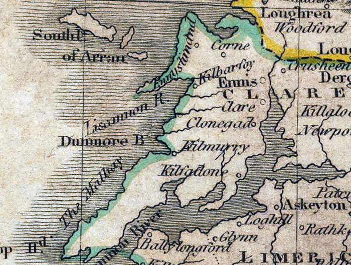
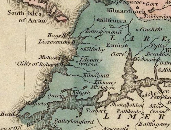
As part of Tooreen was in the townland of Kilfarboy, which, as the one-time ecclesiastical centre of the parish, appears on many maps, these are given here:
Moland's map of 1703
Nicholas-Visscher-1689.jpg
Frederick-de-Wit-17??--.jpg
Robert De Vaugondy- Giles-1750.jpg
Thomas-Kitchin_1788_A.jpg
John Rocque-1790.jpg
Daniel Beaufort-1797.jpg
William Faden-1798.jpg
Weidner-1801.jpg
John Pinkerton-1813.jpg
John Thomson-1815.jpg
Mathew Carey-1820.jpg
Lucas Fielding-1823.jpg
Sidney Hall, 1830.jpg
Henry S Tanner1836.jpg
Lewis, 1837,.jpg
Placenames.
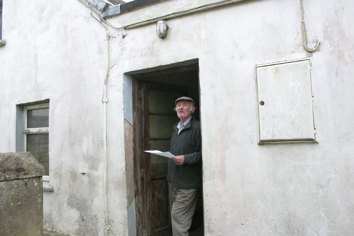
IT SHOULD BE NOTED THAT ALMOST ALL OF THE INFORMATION BELOW WAS PROVIDED BY MICHAEL JOE MCMAHON who lives in Glendine North and farms there, as well as in Tooreen and Silverhill. Any mistakes below, however, are the fault of the author.
Schools Folklore.
The Schools Folklore Project was organised by the Department of Irish folklore in 1938. Using guidelines provided by the Department the teachers arranged for the pupils to collect folklore from the old people of their district. One of the headings for the collection was Local Placenames. Many of the children from Glendine attended Letterkelly National School and the folklore collection for that school contains a substantial Placenames list. Unfortunately the list, which obviously covers a very wide geographical area, gives no indication of location for the places named.
The Placenames
Tooreen – Tuairín, small bleach or green field, this is the meaning given in the Field Name Book . This is also the most common meaning attributed to Tuairín in placename studies although it is generally accepted that the name may also refer to any small field near to a residence or more particularly, a field where livestock were penned at night, during winter, the poached field would then be used for tillage in the following Spring. A bleach green presupposes that flax was grown locally and we know that this was the case in Clare in the 18th century (the poet Brian Merriman was awarded two premiums by the Trustees of the Linen Manufacture in 1796 because of the excellence of his flax crop). There is not, however any evidence to show that the crop was grown on a very extensive scale in the earlier centuries when the placename structure developed – there are nine townlands in Clare with ‘Toor’ as the first element. It may well be the case that that the word ‘Tuar’ originally referred to a field where cattle were penned at night, as was always the practise when the countryside was populated with wolves, up to say, the 16th century. Possibly the demise of the wolf flocks corresponded with the increase in cultivation of flax growing and the cattle pens found a new reversed use – to keep the cattle out rather than in and thus protect the bleaching linen.
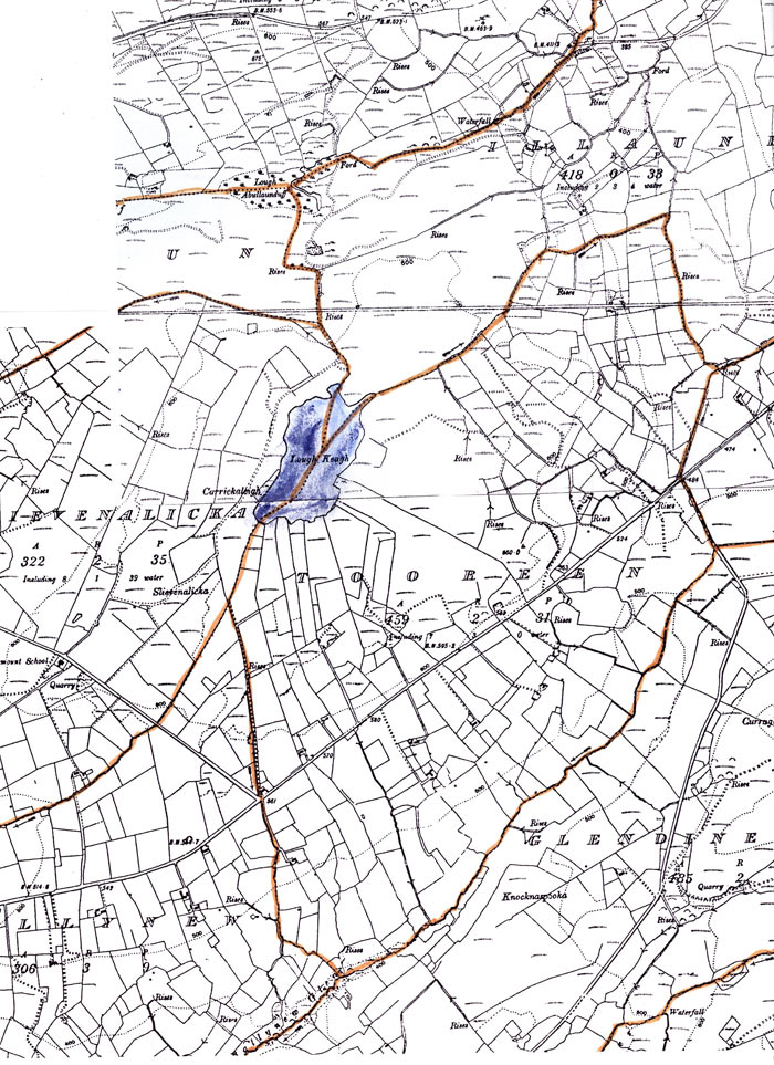
Tooreen map 1920
1. Cool Slieve [- Cúl Sliabh, (recte Cúl Sléibhe), the Back of the Hill], on the boundary with the townland of Illaunbawn. The meaning is self-explanatory.
Location map for No.1 Cool Slieve,
Pronunciation
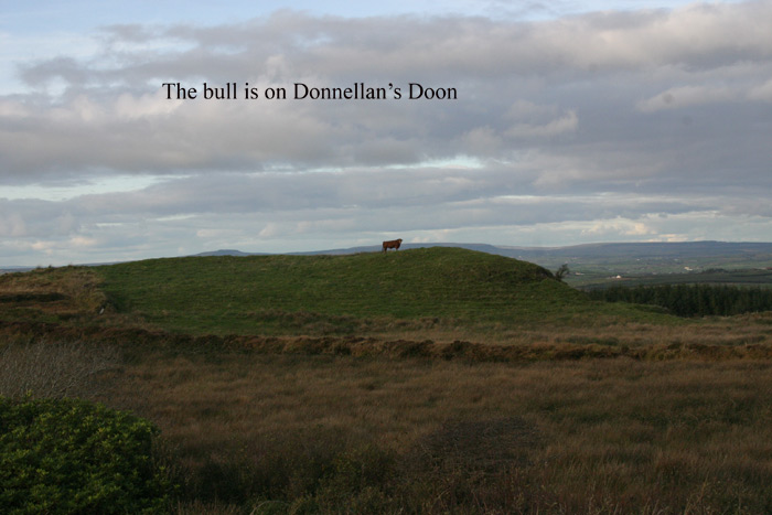
2. Donnellan’s Doon [– Dún, a Fort, a Place, etc]. The Doons (see also No. 3 to 5 below) are a series of flat topped hillocks on the North –western boundary of the townland, they are believed to be of natural occurance and are named after the respective owners of the farms in which they are located.
Location map for No. 2 - Donnellan's Doon
Photo -Donnellan's Doon
Pronunciation
3. Kinnoulty’s Doon [- Dún , a Fort, a Place]. (see no. 2 above) Michael Joe McMahon asserts that the Kinoulty family came from the North of Ireland and settled in the parish of Cloona, (now part of Ennistymon Parish) in the early 1780s. This is substantiated to some extent by the comment of John Lloyd in his ‘Tour of Clare ---‘published in 1780 “A detour takes us to Mount Callan, the "fruitful environs" of which "are inhabited by the, descendants of Northern or Ultonian emigrants to this county during the late wars in this kingdom; they are an honest endeavouring people". Lloyd is referring to the Cromwellian transplantations.
Kinoulty’s Doon was also known as Doon a' Sigh, from Dún na Shí, Fairies Fort. All of this area was celebrated for supernatural beings.
Location map for No. 3 - Kinoulty's Doon
Photo, Kinoulty's Doon
Pronunciation
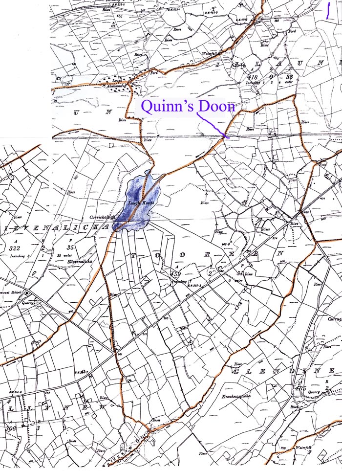
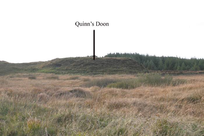
4. Quinns Doon [– Dún, a Fort, a Place, etc] (see No 2 above). This was the property of the Quinn family.
Location map for No. 4 - Quinn's Doon
Photo - Quinn's-Doon
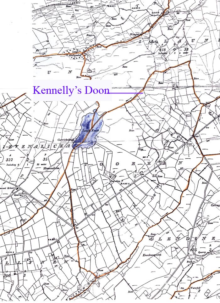
5. Kennelly’s Doon [- Dún, a Fort, a Place], (see No. 2 above). Property of the Kennelly family.
Location map for no 5 - Kennelly's Doon
Pronunciation
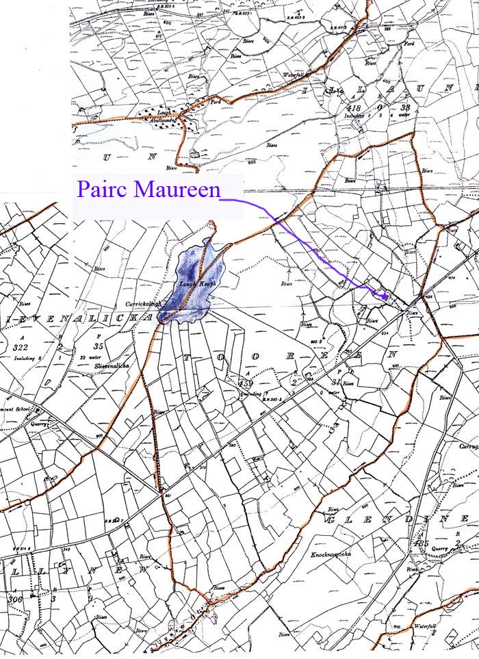
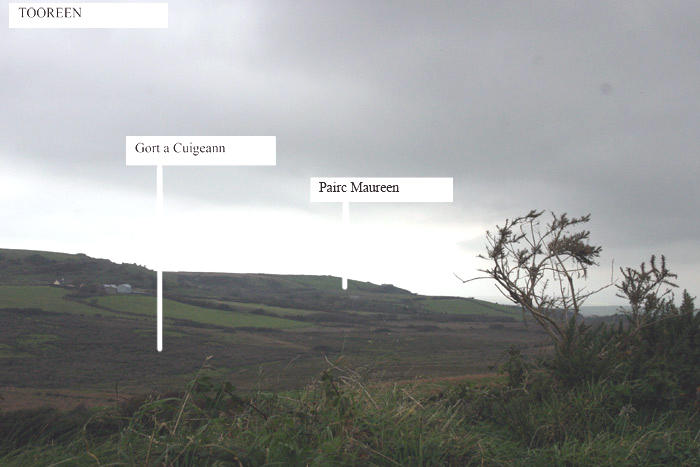
6. Pairc Maureen [– Pairc Máirín, Maureen’s Field]. Origin of name unknown.
Location map for No. 6 - Pairc Maureen
Photo - Pairc Maureen
Pronunciation
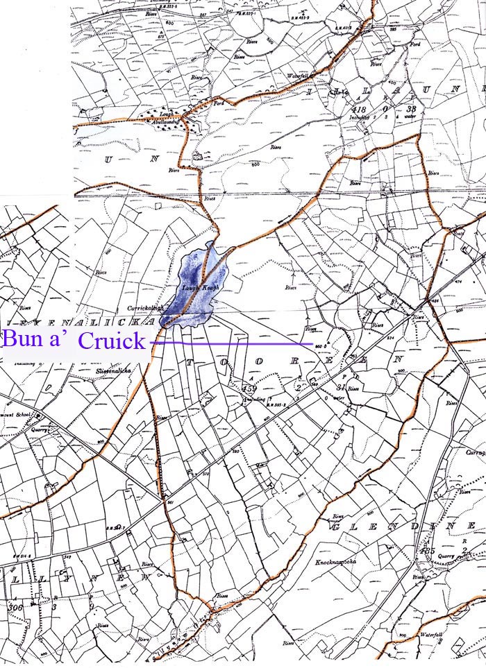
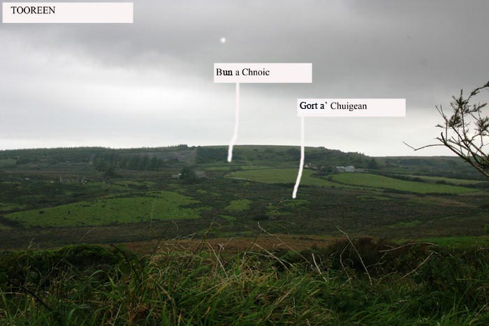
7. Bun a Cruick [– Bun an Chnoic], Bottom of the Hill.
Location map for No. 7 - Bun a Cruick
Photo - Bun a Cruick
Pronunciation
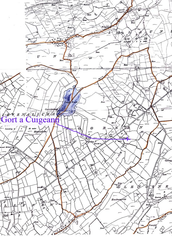
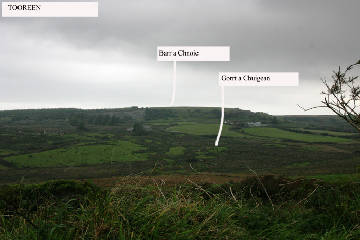
8. Gort a Cuigeann – Gort a’Chuigeann (recte Gort an Chuighinne) The Field of the Churn or Buttermaking. This field was believed to be haunted because of a sound, heard there at night, which resembled the sound of a churn-staff at butter-making. In this area it was considered unusual for anyone out at night not to have some supernatural encounter.
Location map for No. 8 - Gort a' Cuigeann
Photo - Gort a' Cuigeann
Pronunciation
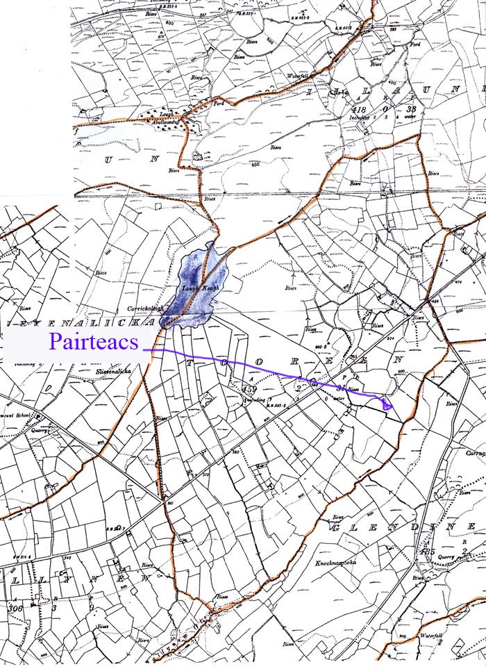
9. Pairteacs [– Pairteach, probable abr. Moinéar or Talamh Páirteach, Shared Land or Meadow]. This seems to refer to a time when the land was held under what was called the Rundale system by which land was held in shared (originally family kin group)ownership. The land was unfenced and allocated among the participants in strips in such a way that everyone got a share of the different qualities of land in the holding. The allocations were regularly switched around among the participants, by lottery. The name Rundale derives from Roinn Dáil, Division by Committee. The system is explained in detail in an article by Tom Yager -‘What is Rundale and where did it come from?’ in Béaloideas 2002. The name Móinéar Páirteach occurs in Dough townland also.
Location map for no 9 - Pairteacs
Pronunciation
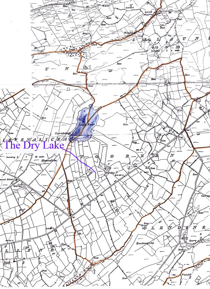
10. The Dry Lake. Also called Charley’s Dry Lake. This is believed to have dried up as a result of quarrying activity, which lowered the water table. Although it is noted in the Field Name Book as Loch tirm, dry lake, it is shown on the resulting map of 1842 as a water body.
Location map for No. 10.- the Dry Lake (site of. )
11. Gort an Aiteann [– Gort an Aiteann, the Field of the Furze].
Location map for No. 11. - Gort an Aiteann
Pronunciation
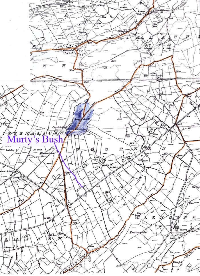
12. Murty’s Bush, Named after Murty Talty who once lived nearby, the spot was ‘highly dangerous’ because of the ghosts that frequented it. Supernatural apparitions were common in the area – see Nos. 3 and 8 above and Francie Kennelly's story of the ‘Hound of Tooreen’ gives another manifestation of them.
Location map for No.12. - Murty's Bush
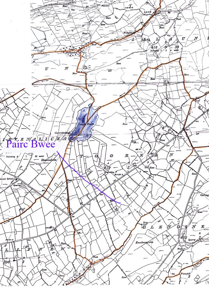
13. Pairc Bwee [– Pairc Bhuí, the Yellow Field]. Presumably the field was called after either the soil or the foliage.
Location map for No. 16 - Pairc Bwee
Pronunciation
- Log in to post comments