Fáilte
Glendine North Summary
CIVIL PARISH OF KILFARBOY - R.C. PARISH OF MILTOWN MALBAY.
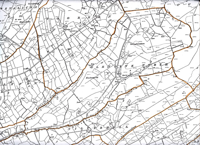
TOWNLAND OF GLENDINE NORTH.
Introduction – The evolution of townlands.
Townlands are the smallest administrative unit of Irish local government. The network of townlands, as it now stands was laid out in the first half of the 19th century. The Boundary Survey commenced work in 1824, marking out, on the ground, where necessary, the actual boundaries of every townland. Where they felt it necessary, they subdivided the pre-existing land divisions, to create smaller units. The Ordnance Survey built on the work of the Boundary Commission to produce maps of the entire country at a scale of 6” to the statute mile. This was done in County Clare during the 1830s.
As part of their work the Ordnance Survey carried out an extensive documentary and field survey of placenames and recorded the results of their work in Field Name Books. Some, but not necessarily all of the names recorded in the Field Name Books were incorporated in the subsequent maps. The Ordnance Survey set down definitive names for each townland and also for other features entered in the Name Books, these were signed with the initials J oD, presumably for John O Donovan, although not all of the initials were by the same hand. The information collected during the 1830s was first published in map of 1842
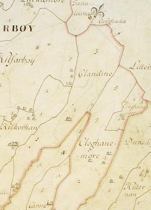
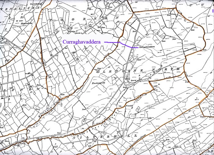
Prior to the development of the townland system the lands of Ibrickane Barony were denominated in ‘quarters’ and the earliest known list of these quarters is from a survey of the O Brien estates by Henry Illsworth in 1615 in which he lists 63 quarters and gives the names of the immediate lessors. Further surveys by the O Brien Estates always accounted for approximately the same number of quarters. Glendine was always listed in the early surveys as a quarter in its own right and it would have included the present-day townlands of Glendine North and South and also Caherogan, Knockbrack, Cloughan Beg, Silverhill and part of Tooreen, although Cloughan Beg was treated as a quarter in its own rite in most surveys.
In all, for the barony of Ibrickane, the Ordnance Survey created 110 townlands (counting Mutton Island as one) from the earlier 63 quarters. Thus Kilfarboy has 40 townlands, Kilmurry Ibrickane 51 (including Mutton Island) and Killard 19.
Early maps.
As Glendine did not have any concentrated human settlement, nor any ‘big houses’ it rarely figured on maps prior to the first map by the Ordnance Survey in 1842. The maps on which it was shown are:
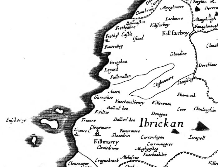
William Petty's map of 1685, and
Pelham's Map of 1787 which shows the general area between Clohanmore and Miltown Malbay only.
Moland's map of 1703
Schools Folklore.
The Schools Folklore Project was organised by the Department of Irish folklore in 1938. Using guidelines provided by the Department the teachers arranged for the pupils to collect folklore from the old people of their district. One of the headings for the collection was Local Placenames. Many of the children from Glendine attended Letterkelly National School and the folklore collection for that school contains a substantial Placenames list. Unfortunately the list, which obviously covers a very wide geographical area, gives no indication of location for the places named.
Placenames.
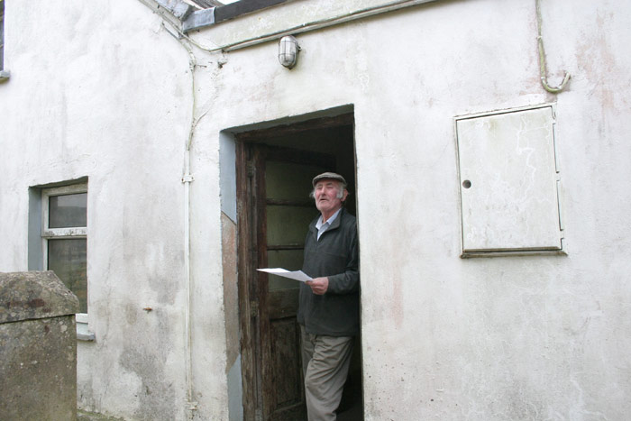
IT SHOULD BE NOTED THAT MOST OF THE INFORMATION BELOW WAS PROVIDED BY MICHAEL JOE MCMAHON who lives in Glendine North and farms there, as well as in Tooreen and Silverhill. Any mistakes below, however, are the fault of the author.
Glendine [– Gleann Doimhin, Deep Glen.]
photo.
O.S. map of Glendine North- 1920
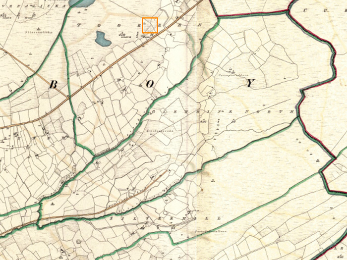
O.S.map of Glendine South - 1920
Field Name Book
1. Clancy’s House, a house now demolished and covered with forestry.
Location map for No. 1 Clancy's house
2. Pairc Luachra [- Pairc Luachra, the rushy meadow]. A good meadow of 17 acres now covered in forestry.
Location map for No. 2 - Pairc Luachra
Pronunciation
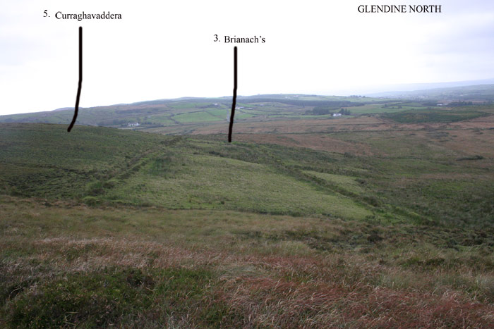
3. Brianachs, - named after a man called Breen who lived there after the famine, although he did not own it. There was a 2 storey house there occupied by Daniel McMahon, for whom Breen worked. The area, which was once intensively farmed is now wild moorland. About 150 years ago a man named McMahon, who lived in this house was transported for making poteen and growing tobacco.
Location map for No. 3 - Brianachs
Photo - Brianachs
Pronunciation
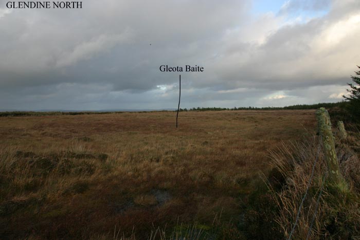
4. Gleota Baite – a marsh where children were drowned on there way to school. The incident is believed to have happened in the first part of the 19th century and the children were apparently travelling from Cloghaunmore to school in Fahanlunaghta or Moy. The place was, subsequently, supposed to be haunted, with the cries of the children who were drowned – hence Gleota, from gleo, noise. It is also, possible that it derives from glóthach, jelly, quivering mass, which perfectly describes the terrain and báite, wet or drowned. In more recent times sphagnum moss was harvested here. The purpose of the harvested moss is uncertain, it may have been used locally for toiletry use or exported to England where there was a strong demand for it during the War as an antiseptic wound dressing.
Location map for No. 4 - Gleota Baite
Photo, Gleota Baite
Pronunciation.
5. Curraghavaddera [– Currach a’ Mhadra, The marsh of the dog.] This is actually high moory ground. The dog in question may have been supernatural and may have been related to The Hound of Tooreen (nearby) as described by Francie Kennelly to Jim Carroll and Pat Mackenzie some years ago. This place is also referred to in the O.S Field Name Book.
Location map for No. 5- Curraghavaddera
Photo - Curraghavaddera
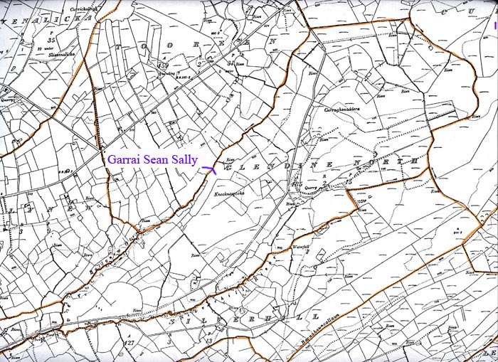
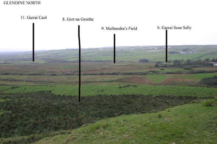
6. Garrai Sean Sally. [- Garrai Sean Sally, Sean Sally’s Field or Garden]. Possibly called after a Sean O Connor, as all the O Connor family were referred to as ‘Sally’
Location map for No 6 - Garrai Sean Sally
Pronunciation
Photo - Garrai Sean Sally
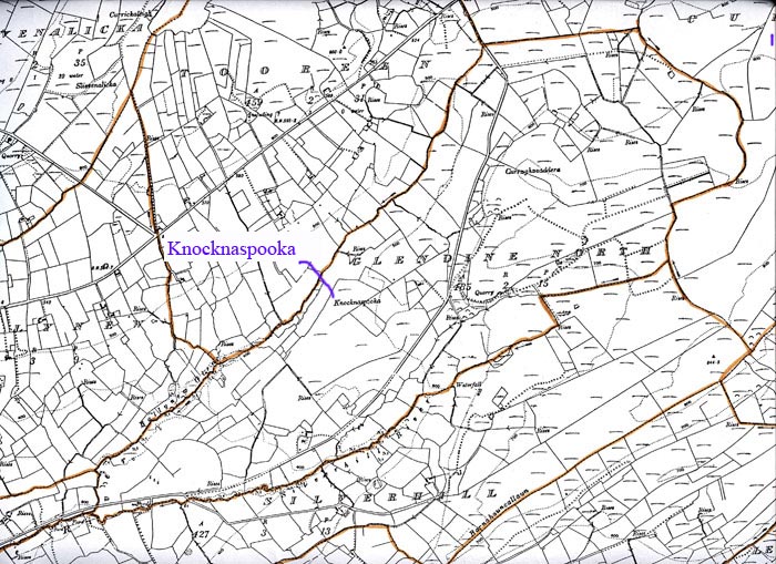
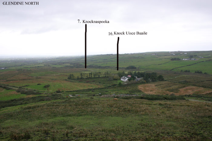
7. Knocknapooka [- Cnoc na Spuaice, The Hill of the Pinnacle]. This is a modest hill, possibly much reduced by quarrying, of which there was a great deal, in this area in former years. (See no. 18 below). It is referred to in O.S. Field Name Books
Location map for No. 7 - Knocknaspooka
Pronunciation (called Spook)
Photo - Knocknaspooka
8. Gort na Groithe- Gort na Gróithe, the meaning is uncertain, it may be the field of the sheep-folds or enclosures, cró, pl. cróithe. Dineen refers to “cró stille, a still-house”, and it is notable that the O.S Field Name Book quoted “Still Fine Returns 1816” as one of the ‘Authorities’ for the name Glendine, The area seems to have acquired somewhat of a reputation for illegal spirits as well as the supernatural kind.
Location map for No. 8 - Gort na Groithe
Pronunciation
Photo - Gort na Groithe
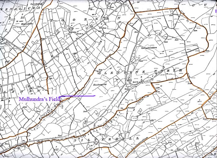
9. Mulhundra’s field. This was a field belonging to a family called Mulhundra whose main residence was some distance away in Fahaanlunaghta. The surname is an Anglicisation of
O Maolchonaire, which translates as ‘the devotee of (saint) Conaire’. The name O Maolchonaire has also been anglicised as Conroy, which in turn was (mis?)translated as ‘Son of the King’ and was given currency in the surname ‘King’.
Location map for No.9 - Mulhundra's field
Photo - Mulhundra's Field
Pronunciation
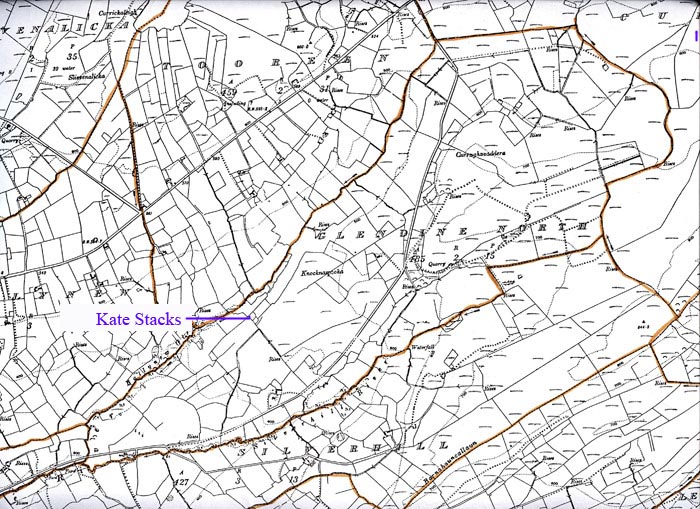
10 Kate Stacks Field. The Stack family lived at Knocknaspooka, but the lady in question cannot now be identified. The present main road through Glendine North is shown on the first O.S map as “New Line of Road” it appears that Kate Stack’s house was on the side of an older road, of wich only vague traces now remain.
Location map for No 10 - Kate Stack's
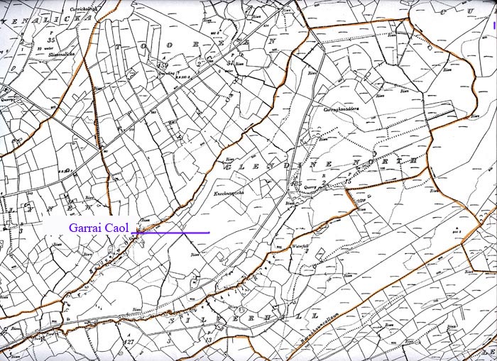
11. Garrai Caol. [- Garrai Caol, the narrow garden]
Location map for No 11 - Garrai Caol
Photo - Garrai Caol
Pronunciation
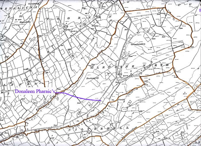
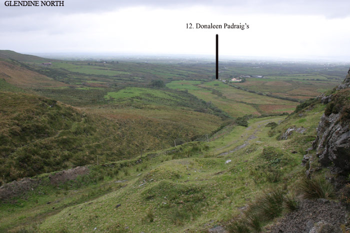
12 Donaleen Pharaic’s. The remains of Donaleen Pharaic McMahon’s mud cabin can still be seen here.
Location map for No. 12 - Donaleen Pharaic's
Photo - Donaleen Phadraig's
pronunciation.
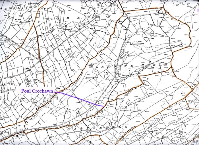
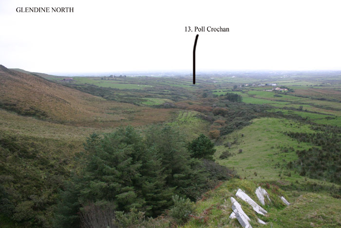
13. Poul Crochawn, This was a stretch of the river where the banks were very steep.
Location map for No13 - Poul Crochawn
Photo Poul Crochawn
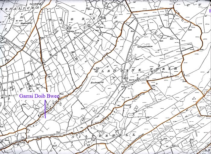
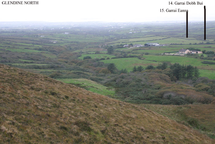
14. Garrai Doib Bwee [– Garrai Dóib Bhuí –Garden of Yellow Clay].
Location map for No 14 - Garrai Doib Bwee
Photo - Garrai Doib Bwee
Pronunciation
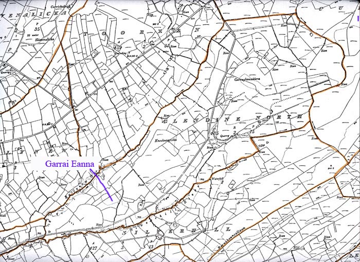
15. Garrai Eanna, [Garrai Eanna, Eanna’s Garden]. There is currently no information on Eanna.
Location map for No 15 - Garrai Eanna
Photo - Garrai Eanna
Pronunciation
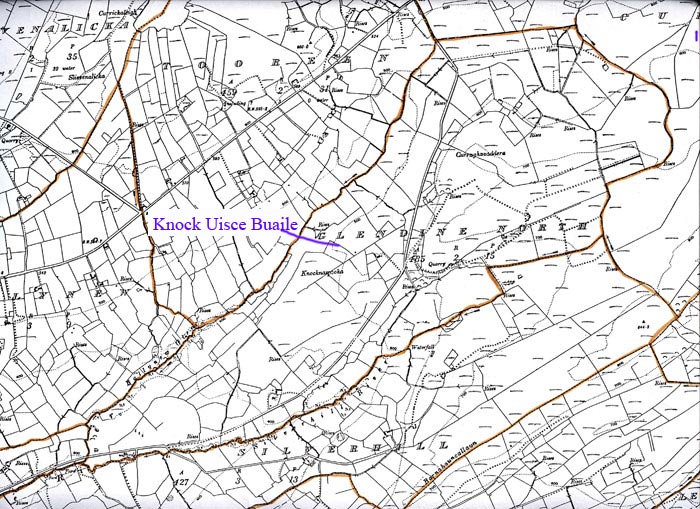
16. Knock an Uisce Booley - The Hill of the Booley Water. It is difficult to account for this name. A booley is an uncultivated district, usually on high ground where cattle were brought in Summer, for the dual purpose of taking advantage of mountain grass for the cattle and preventing interference by the cattle in the tillage fields which were located around the permanent houses. It was a very common practise in this part of Clare and the word Booley forms part of many placenames. Perhaps ‘Uisce Buaile’ , the Booley Waters, was an early name for the Ballynew river, which rises in the high ground in Silverhill, known as the ‘Buaile’.
Location map for No. 16 - Knock an Uisce Buaile
Pronunciation
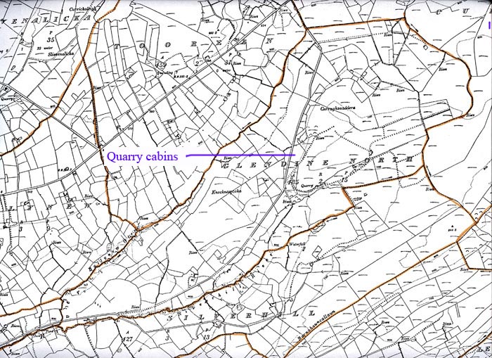
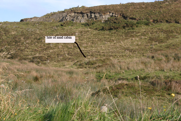
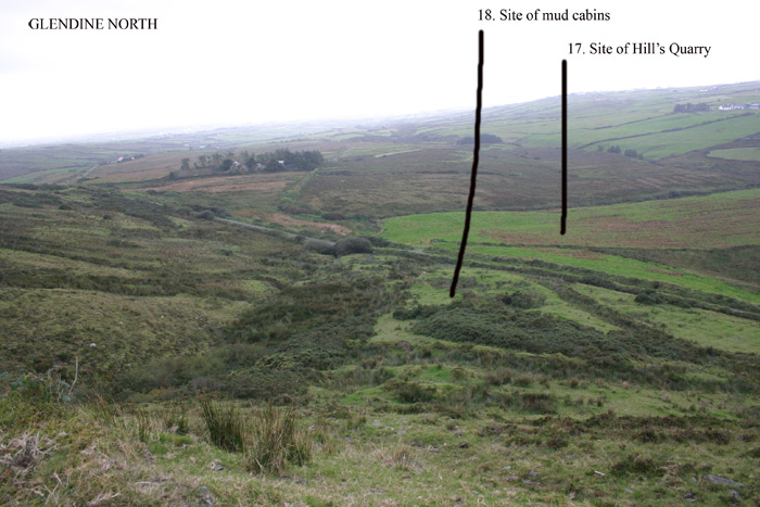
17. Site of Mud Cabins. See No 18. Below
Location map for no. 17 - Site of Quarry cabins
Photo - site of mud cabins
Photo 2 Mud cabin, from above
18. Site of Hill’s Quarry – The Hills were a substantial family in the area and operated this quarry, which produced a very fine quality stone, in the late 19th century. The quarry was on the Western side of the Glendine road and on the Eastern side of the road there were mud cabins occupied by the quarry workers. Substantial remnants of these mud cabins are still clearly visible.
Location map for no. 18 - Hill's Quarry
Photo site of Hill's quarry
19. Ceimashanavoe [- Céim a Sean Bhó the Step or Track of the Old Cow, or Geim a Sean Bhó The Bellow of the Old Cow], This is described by the Field Name books as being located “In the townland boundaries of Silverhill and Glandine”. It is described as “A large high hill”. I have not found any memory of the name but there are many traces of old roads in the location indicated by the namebooks. There is a townland in the neighbouring parish of Kilmurry Ibrickane called Shanaway which derives from the Irish Sean Bhoth, the Old Cabin, although the element Both in placenames often signifies a church. In this context it is possible that Ceimashanavoe referred to a Road to the Old Church, most of the traces of old roads are orientated towards Shanaway.
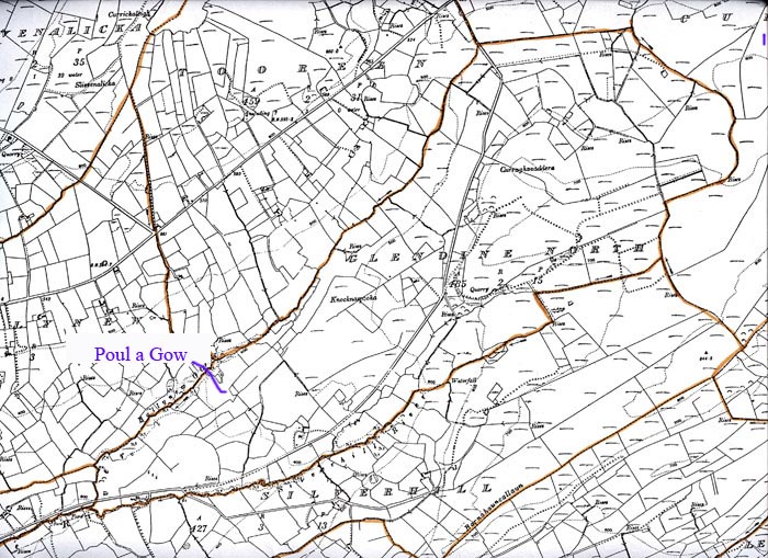
20. Poul a Gow [- Poll a Gabha, the hole of the Blacksmith]
Location map for No. 20 - Poul a Gow
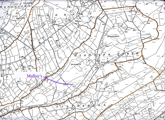
21 Mulloys House. Once the residence of the Mulloys who owned substantial tracts land, locally.
Location map for No. 21 - Mulloy's
22. The O.S. Field Namebook refers to a fort called Lissakith in this townland but they did not show it on any map, nor is now known locally.
- Log in to post comments